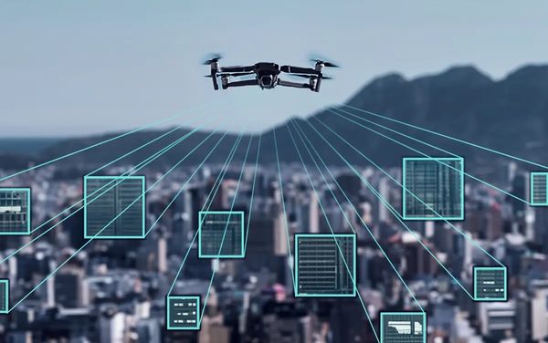
D A A S - Drone As A Service

D A A S - Drone As A Service
Drones in agriculture provide precision farming by enabling efficient crop monitoring, targeted spraying of pesticides and fertilizers, soil analysis, and irrigation management. These unmanned aerial vehicles (UAVs) reduce manual labor, optimize resource use, lower costs, and enhance crop yields by providing real-time data and improving efficiency.

Drones are used in swarms to give a 3D show in the sky
and Drone Video Shoots for Events, Festivals, Real Estate & Hotels,
These Drones reduce manual Videography, stabilised Videos, optimise resource use and lower costs.

Drones enhance security by providing aerial surveillance with high-quality video and sensors that can monitor large areas, detect intruders or suspicious activity, and offer real-time situational awareness from a bird's-eye view. They allow for faster response times, can monitor areas inaccessible to humans, and can be equipped with night vision or thermal cameras for low-light conditions.

Drones are critical in defense for providing persistent surveillance, conducting reconnaissance, and enabling precision strikes with reduced risk to personnel, which are essential for modern warfare and force safety. Key applications include intelligence, surveillance, target acquisition, and reconnaissance (ISTAR), but also extend to electronic warfare, logistics, and target training.
Drones provide invaluable real-time situational awareness, faster delivery of life-saving medical supplies like AEDs and naloxone, and enhanced search and rescue capabilities for emergency services. They are used for rapid damage assessment after disasters, delivering essential items like food and water to isolated areas, and even acting as temporary communication hubs. By providing "eyes in the sky" and reaching difficult locations quickly, drones augment traditional emergency response efforts and improve overall public safety.

Drones enhance forest mapping by providing detailed, real-time aerial data for monitoring health, deforestation, and wildlife, enabling efficient resource management, reforestation planning, and wildfire detection. They use high-resolution cameras and sensors to map tree canopy, forest structure, and vulnerable areas, with AI algorithms further refining analysis to identify pest infestations and carbon sequestration potential.

Drones revolutionized land mapping by providing faster, safer, and more cost-effective data collection using high-resolution cameras and sensors to create 2D maps, 3D models, and elevation data. This Unmanned Aerial Vehicle (UAV)-based approach offers significant advantages over traditional methods, enabling precise aerial data capture for applications in construction, agriculture, environmental assessment, and urban planning.

Drones improve mine mapping by using cameras and LiDAR sensors to quickly and accurately gather data for detailed topographic maps, 3D models, and stockpile volume calculations.This allows for faster and safer site planning, resource assessment, and inspection of hazardous underground areas without sending personnel into dangerous locations. Drones enhance safety by reducing exposure to risks, increase efficiency by speeding up data collection, and improve cost-effectiveness by minimizing labor and time compared to traditional survey methods.

Drones enhance the telecom industry by performing safe, efficient inspections of infrastructure, surveying for new deployments, optimizing network performance, and providing crucial data in disaster recovery scenarios. They improve safety by removing humans from dangerous tower climbs, increase efficiency by rapidly collecting data with high-resolution cameras and sensors, and reduce costs for maintenance and site planning

Drones are used to inspect power lines for faults, damage, and vegetation encroachment, enhancing safety and efficiency in power line maintenance. These unmanned aerial vehicles (UAVs) are equipped with high-resolution cameras and thermal sensors to detect issues like corrosion, wear, or overheating components.This technology provides detailed imagery and data, allowing utility companies to conduct proactive maintenance, prevent outages, and reduce the risks and costs associated with traditional manual inspections

A drone for logistics is an unmanned aerial vehicle (UAV) specifically designed and equipped to transport goods, such as packages, medical supplies, or food, from one location to another, optimizing supply chain operations. These autonomous or semi-autonomous flying robots offer benefits like faster delivery times, increased efficiency by avoiding traffic, cost reduction compared to traditional methods, and the ability to reach remote or challenging locations inaccessible by ground vehicles

An Automated Guided Vehicle (AGV) is an unmanned, self-powered robot for moving materials in Agriculture, Crop Health, industrial, warehouse, and logistics environments. AGVs use various navigation technologies, such as lasers, cameras, magnetic tapes, or embedded wires, to autonomously follow predefined paths and avoid obstacles to transport loads like pallets or boxes. They are central to material handling automation, enhancing safety, reducing manual labor, and improving operational efficiency by automating repetitive transport tasks
Flat No. 402, Ashadeep Building, 9 Hailey Road, New Delhi - 110001


Copyright © 2025 URV AURA - All Rights Reserved.
We use cookies to analyze website traffic and optimize your website experience. By accepting our use of cookies, your data will be aggregated with all other user data.